


Dayton P-2, Hennepin County, Minnesota
About
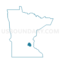
Outline

Summary
| Unique Area Identifier | 602171 |
| Name | Dayton P-2 |
| County | Hennepin County |
| State | Minnesota |
| Area (square miles) | 5.01 |
| Land Area (square miles) | 4.53 |
| Water Area (square miles) | 0.48 |
| % of Land Area | 90.49 |
| % of Water Area | 9.51 |
| Latitude of the Internal Point | 45.22245740 |
| Longtitude of the Internal Point | -93.49390150 |
Maps


Graphs
Select a template below for downloading or customizing gragh for Dayton P-2, Hennepin County, Minnesota


Neighbors
Neighoring Voting District (by Name) Neighboring Voting District on the Map
- Dayton Voting District, Wright County, MN
- Dayton P-1, Hennepin County, MN
- Dayton P-3, Hennepin County, MN
- Elk River W-4 P-4B, Sherburne County, MN
- Hassan Twp. P-1, Hennepin County, MN
- Otsego Voting District, Wright County, MN
- Ramsey W-3 P-1, Anoka County, MN
- Rogers P-1, Hennepin County, MN
Top 10 Neighboring County Subdivision (by Population) Neighboring County Subdivision on the Map
- Ramsey city, Anoka County, MN (23,668)
- Elk River city, Sherburne County, MN (22,974)
- Otsego city, Wright County, MN (13,571)
- Rogers city, Hennepin County, MN (8,597)
- Dayton city, Hennepin County, MN (4,617)
- Hassan township, Hennepin County, MN (2,600)
- Dayton city, Wright County, MN (54)
Top 10 Neighboring Place (by Population) Neighboring Place on the Map
- Ramsey city, MN (23,668)
- Elk River city, MN (22,974)
- Otsego city, MN (13,571)
- Rogers city, MN (8,597)
- Dayton city, MN (4,671)
Top 10 Neighboring Unified School District (by Population) Neighboring Unified School District on the Map
Top 10 Neighboring State Legislative District Lower Chamber (by Population) Neighboring State Legislative District Lower Chamber on the Map
- State House District 19B, MN (59,068)
- State House District 32A, MN (55,517)
- State House District 48A, MN (45,476)
- State House District 48B, MN (40,810)
Top 10 Neighboring State Legislative District Upper Chamber (by Population) Neighboring State Legislative District Upper Chamber on the Map
- State Senate District 19, MN (106,452)
- State Senate District 32, MN (90,959)
- State Senate District 48, MN (86,286)
Top 10 Neighboring 111th Congressional District (by Population) Neighboring 111th Congressional District on the Map
Top 10 Neighboring Census Tract (by Population) Neighboring Census Tract on the Map
- Census Tract 1008.02, Wright County, MN (13,797)
- Census Tract 1001, Wright County, MN (12,767)
- Census Tract 269.09, Hennepin County, MN (11,806)
- Census Tract 305.02, Sherburne County, MN (11,141)
- Census Tract 502.28, Anoka County, MN (4,893)
- Census Tract 269.10, Hennepin County, MN (4,617)